
BusConnects
WHAT IS BUSCONNECTS?
BusConnects is the National Transport Authority’s (NTA) programme to greatly improve bus services in Dublin, Cork, Limerick and Galway. It is a key part of the Government’s policy to improve public transport and address climate change in Ireland’s major urban centres. Since 2019 we have worked with the NTA to help communicate the proposed improvements to both the Network and the New Bus Corridors.
WHAT We've done
-
Brand Strategy
-
Concept
-
Brochure and Leaflet Design
-
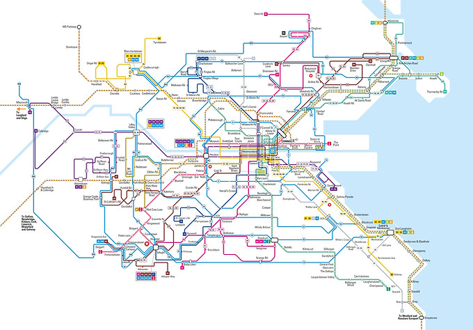
Network Mapping and Design
-
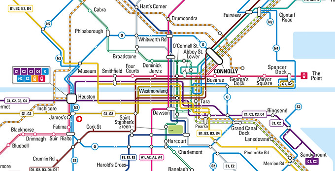
Schematics
-
Infographics
-
Pulls Ups and Backdrop
-
Social Media
-
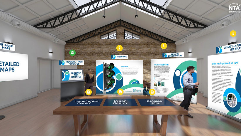
Virtual rooms
-
Bus Schematic Carousels
-
OOH
-
Radio
ADVERTISING - Corridors
BusConnects Dublin - At its core is a desire to greatly improve bus services across the Dublin region. How could a project that was promising to deliver an enhanced bus system that is better for the city, its people and the environment be so disliked, distrusted and misunderstood?
The solution lay in simply looking at the problem from the consumers point of view. What were consumers seeing and hearing and why didn’t they see it like we did? We believed that the key to success lay in the facts - fool proof, unequivocal information that could not be distorted. The key to success was to present the information in a palatable and non-confrontational way so as not to appear to bully, and secondly to get people to understand that the proposals were just that, proposals, and that the NTA would actually like to hear from them. Using this as our core strategy we developed communications that educated, helped alleviate fears, and gave residents the actual facts in a palatable and non-confrontational way and that delivered clarity, simplicity and certainty. Imagine that!


ADVERTISING - Network


Public Consultation Brochures


Virtual rooms

Cartography and Schematics
Created bespoke maps for the greater Dublin area showing all proposed BusConnects routes. We also created multi transport Schematic maps for use in brochures and directional posters and bus poles throughout the city.

Icons and Infographics


